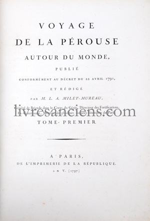

LA PEROUSE, Jean-François de Galaup (Comte de). Voyage de la Pérouse autour du Monde, publié conformément au décret du 22 Avril 1791, et rédigé par M. L.A. Milet-Mureau. 1797.

LA PEROUSE, Jean-François de Galaup (Comte de).
Voyage de la Pérouse autour du Monde, publié conformément au décret du 22 Avril 1791, et rédigé par M. L.A. Milet-Mureau.
Paris, Imprimerie De La Republique, 1797.
Quatre tomes in quarto (293x221 mm), frontispice, (4)-lxxii-346-(2) pages / (4)-398-(2) pages / (4)-422-(2) pages / (4)-309-(1 bl.) pages et un atlas grand in Folio (618x453 mm), 1 feuillet (titre) et 69 planches hors texte. reliure : Demi veau du dix-neuvième siècle pour les volumes de texte et demi veau dépareillé du vingtième siècle pour l'atlas. Les volumes de texte sont frais malgré une petite mouillure angulaire au tome 3. Un coin cassé et un petit manque au dos du tome 3.
L'atlas est relié sur brochure, non rogné, à toutes marges. Quelques salissures et petit manque en marge. Une mouillure en marge haute à partir de la planche 45.

Edition originale.
L'une des plus importantes expéditions scientifiques jamais entreprise vers le Pacifique et la côte ouest de l'Amérique du Nord.
Exemplaire bien complet.
Louis XVI confia à La Pérouse le commandement d'une expédition scientifique visant à continuer l'exploration du Pacifique.
Au cours de ce long voyage, à bord de deux corvettes, La Boussole et L'Astrolabe, ils visitèrent le Chili, l'île de Pâques (ils firent le relevé minutieux des statues), les îles Hawaï (leur position en sera d'ailleurs rectifiée), l'Alaska, la Californie, Macao, Manille, les mers de Chine et du Japon, les îles Tonga, et enfin Botany Bay.
Mais en 1788, les navires firent naufrage sur les récifs des îles Santa Cruz, et l’équipage disparut.
Le récit de son voyage fut publié d'après les documents que La Pérouse avait fait porter en France, en particulier par son interprète, Barthélémy de Lesseps, débarqué au Kamtchatka.
"L'un des plus beaux récits d'exploration maritime jamais écrits" (Howell).
références: Hill [972 : "One of the most important scientific explorations ever undertaken to the Pacific and the west coast of North America."], Ferguson [268 : "The most significant results of the voyage are the charts of then imperfectly known Asiatic coast of the Pacific. En route to Kamchatka, La Pérouse was the first explorer to navigate safely and chart the Japan Sea and the strait between the island of Sakhalin and the northernmost island of Japan, which bears his name… Of particular interest to Hawaii is the plate that depicts the French ships off Makena, Maui. It is the first fully developed view of that island"].
Vendu


