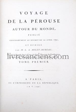

LA PEROUSE, Jean-François de Galaup (Comte de). Voyage de la Pérouse autour du Monde, publié conformément au décret du 22 Avril 1791, et rédigé par M. L.A. Milet-Mureau. 1797.

LA PEROUSE, Jean-François de Galaup (Comte de).
Voyage de la Pérouse autour du Monde, publié conformément au décret du 22 Avril 1791, et rédigé par M. L.A. Milet-Mureau.
Paris, Imprimerie De La Republique, 1797.
Four text volumes 4to (293x221 mm), frontispiece, (4)-lxxii-346-(2) pages / (4)-398-(2) pages / (4)-422-(2) pages / (4)-309-(1 bl.) pages and the large Folio atlas (618x453 mm), 1 leaf (title) and 69 plates. binding : Nineteenth century quarter calf for the text volumes and twentieth century quarter calf for the atlas (different binding). Text volumes are fresh despite a small angular waterstain in volume 3. One corner broken and a small loss on the spine of volume 3.
The atlas is bound untrimmed, with full margins. Some soiling and small loss in margins. Waterstain in upper margin from plate 45 onwards.

First edition.
A complete copy.
references: Hill [972 : "One of the most important scientific explorations ever undertaken to the Pacific and the west coast of North America."], Ferguson [268 : "The most significant results of the voyage are the charts of then imperfectly known Asiatic coast of the Pacific. En route to Kamchatka, La Pérouse was the first explorer to navigate safely and chart the Japan Sea and the strait between the island of Sakhalin and the northernmost island of Japan, which bears his name… Of particular interest to Hawaii is the plate that depicts the French ships off Makena, Maui. It is the first fully developed view of that island"].
Sold


